Sampling Cerros' Demise: A Radiometric Check on the Elusive Protoclassic
List of Figures
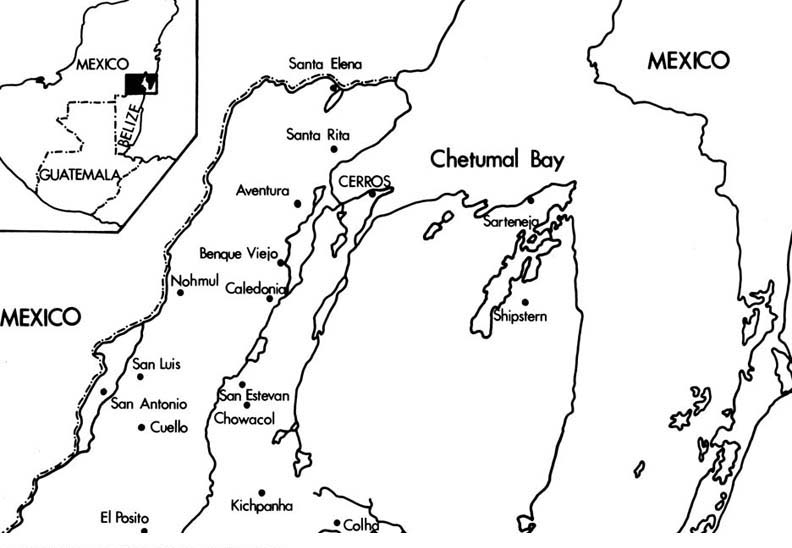
Figure 1. Map of Northern Belize Locating Cerros.
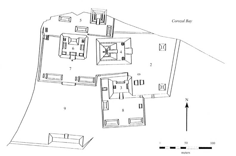
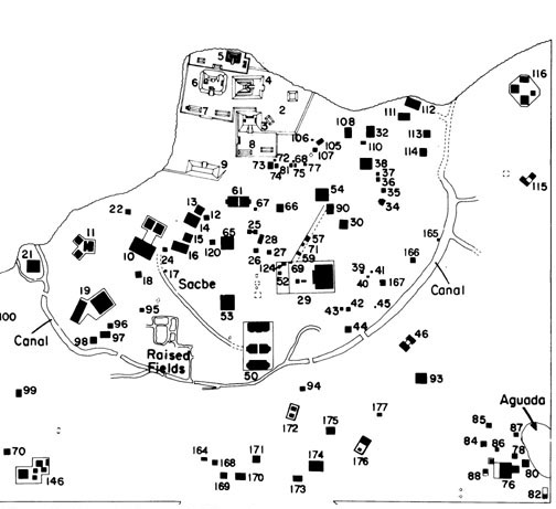
Figure 2. Map of Cerros Site Core.
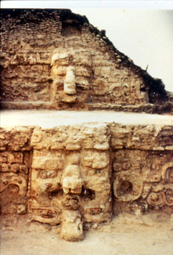
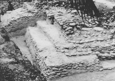
Figure 3. Structure 5C-2nd.
Figure 4. Structure 6B Cache Jewels.
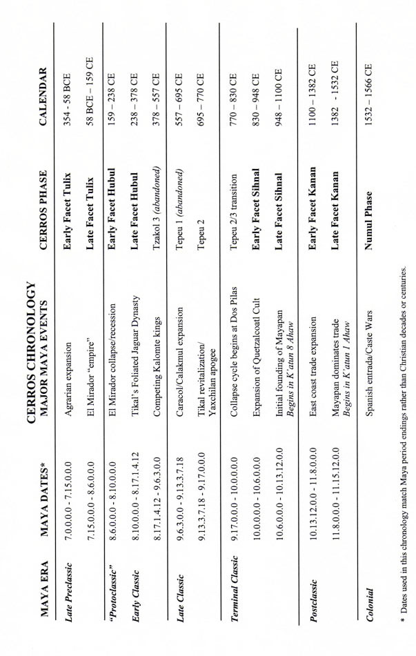
Figure 5. Cerros Ceramic Chronology.
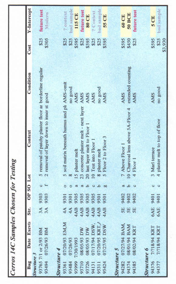
Figure 6. Cerros Carbon Samples Available for Testing.
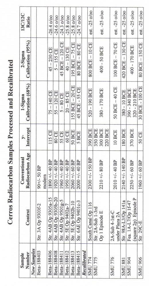
Figure 7. Cerros Radiocarbon Dates Chart.
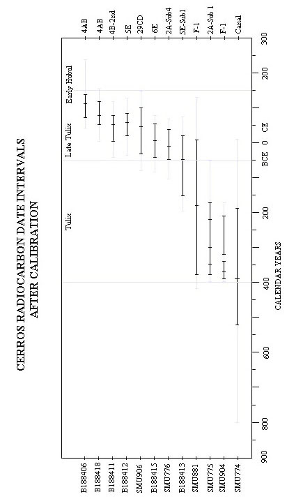
Figure 8. Cerros Radiocarbon Dates Graph.
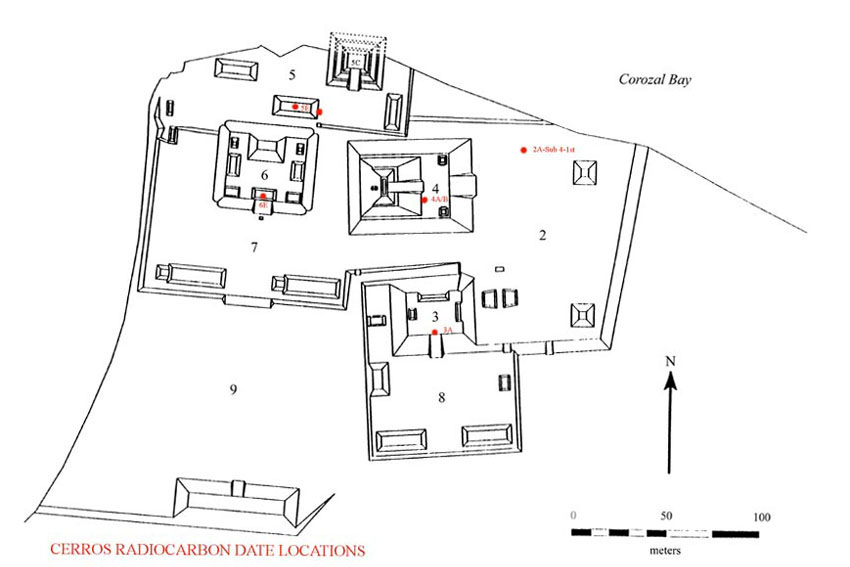
Figure 9. Cerros Site Core Locating Radiocarbon Samples.
Figure 10. Structure 2A-Sub 4-1st.
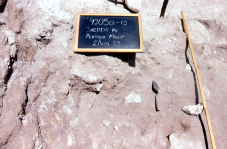
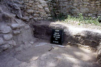
Figure 11. Structure 4A/B Marl Melt from Masks.
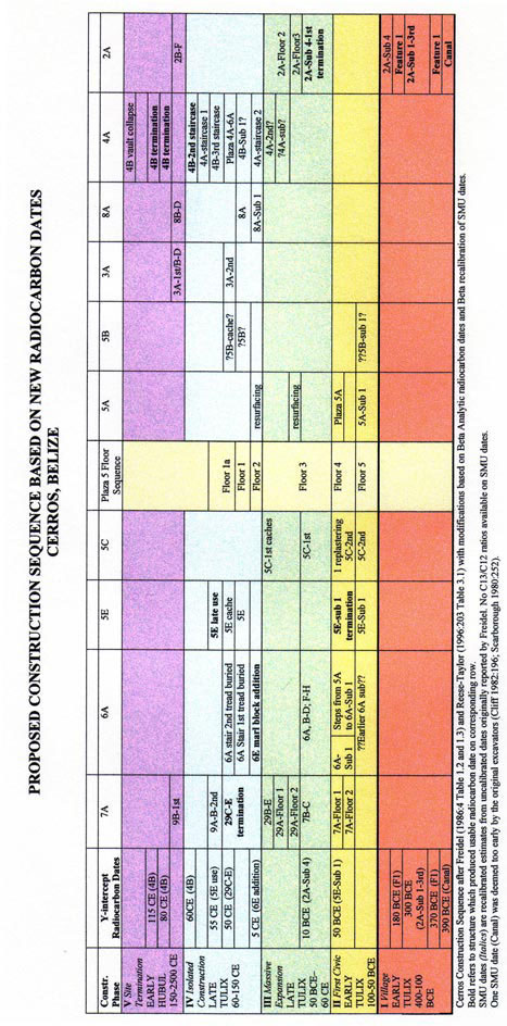
Figure 12. Cerros Proposed Construction Sequence.
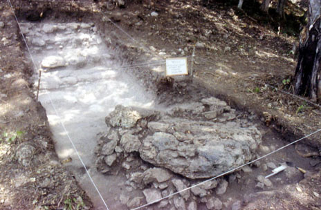
Figure 13. Structure 5E Apsidal Building.
Figure 14. Cerros Dispersed Settlement.
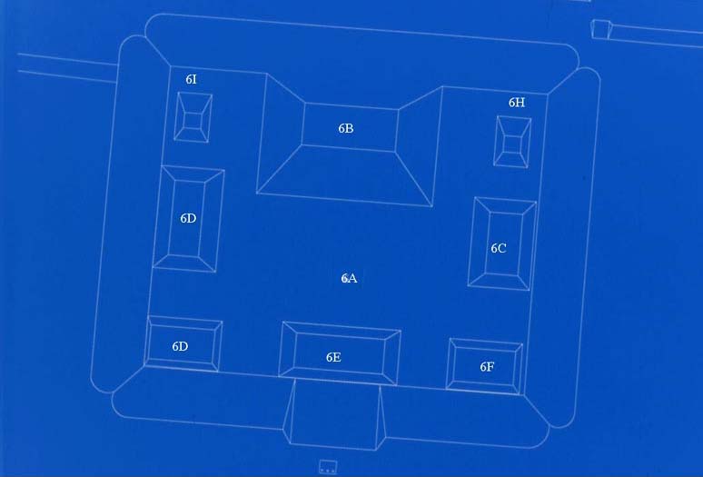
Figure 15. Structure 6 Group.
Figure 16. Base of Structure 6A with Bannerstone.
Figure 17. Structure 4A/B Floor Sequence.
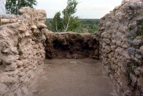
Figure 18. Structure 4B, Chamber 1 Interior.
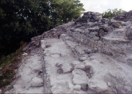
Figure 19. Structure 4B, Summit of Staircase.
Previous Page | Table of Contents | Next Page |