| |
Maya Settlement Patterns and Land Use in Buena Vista, Cozumel, México
List of Figures
Figure 1. Map showing Cozumel location and Buena Vista position in the island.
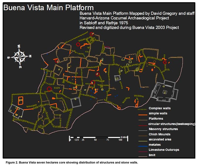
Figure 2. Buena Vista seven hectares core showing distribution of structures and stone walls.
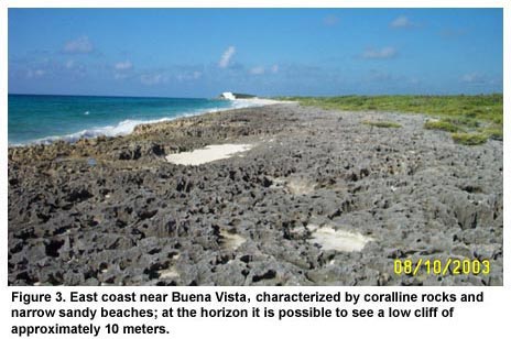
Figure 3. East coast near Buena Vista, characterized by coralline rocks and narrow sandy beaches; at the horizon it is possible to see a low cliff of approximately 10 meters.
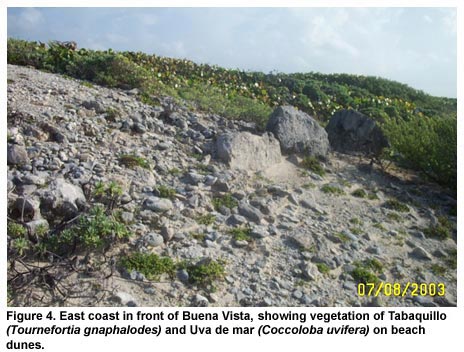
Figure 4. East coast in front of Buena Vista, showing vegetation of Tabaquillo (Tournefortia gnaphalodes) and Uva de mar (Coccoloba uvifera) on beach dunes.
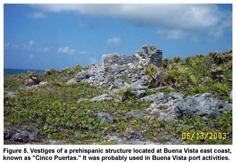
Figure 5. Vestiges of a prehispanic structure located at Buena Vista east coast, known as "Cinco Puertas." It was probably used in Buena Vista port activities.
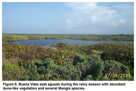
Figure 6. Buena Vista east aguada during the rainy season with abundant dune-like vegetation and several Mangle species.
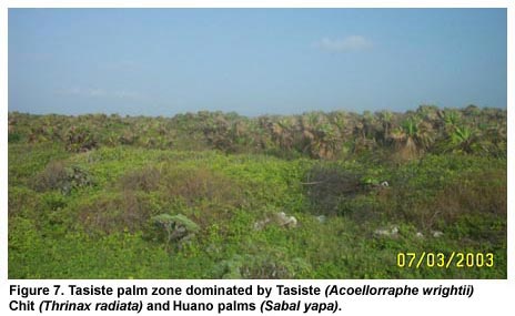
Figure 7. Tasiste palm zone dominated by Tasiste (Acoellorraphe wrightii) Chit (Thrinax radiata) and Huano palms (Sabal yapa).
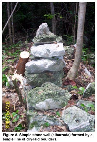
Figure 8. Simple stone wall (albarrada) formed by a single line of dry-laid boulders.
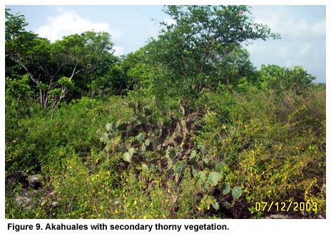
Figure 9. Akahuales with secondary thorny vegetation.
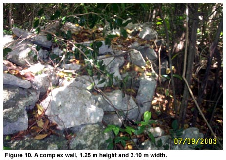
Figure 10. A complex wall, 1.25 m height and 2.10 m width.
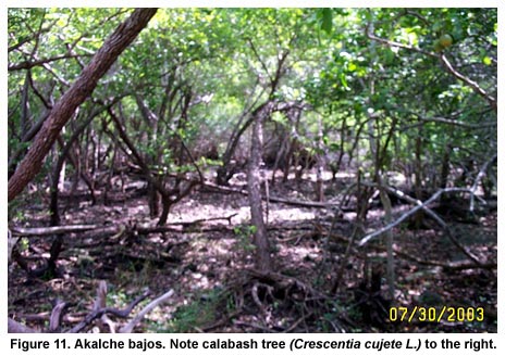
Figure 11. Akalche bajos. Note calabash tree (Crescentia cujete L.) to the right.
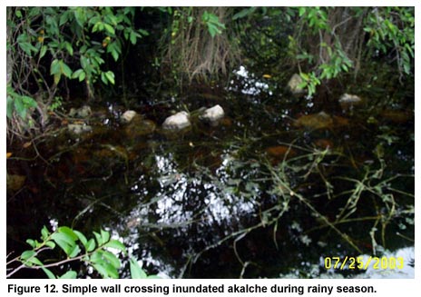
Figure 12. Simple wall crossing inundated akalche during rainy season.
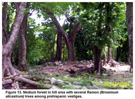
Figure 13. Medium forest in hill area with several Ramon (Brosimum alicastrum) trees among prehispanic vestiges.
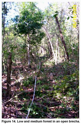
Figure 14. Low and medium forest in an open brecha.
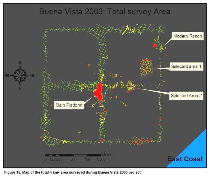
Figure 15. Map of the total 4 km2 area surveyed during Buena Vista 2003 project.
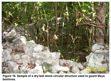
Figure 16. Sample of a dry-laid stone circular structure used to guard Maya beehives.
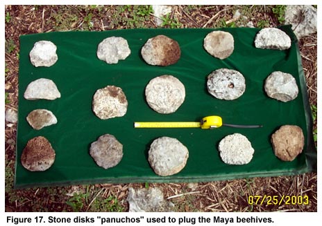
Figure 17. Stone disks "panuchos" used to plug the Maya beehives.
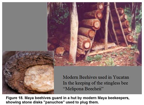
Figure 18. Maya beehives guard in a hut by modern Maya beekeepers, showing stone disks "panuchos" used to plug them.
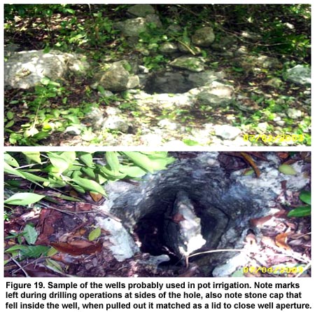
Figure 19. Sample of the wells probably used in pot irrigation. Note marks left during drilling operations at sides of the hole, also note stone cap that fell inside the well, when pulled out it matched as a lid to close well aperture.
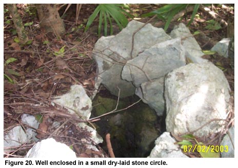
Figure 20. Well enclosed in a small dry-laid stone circle.
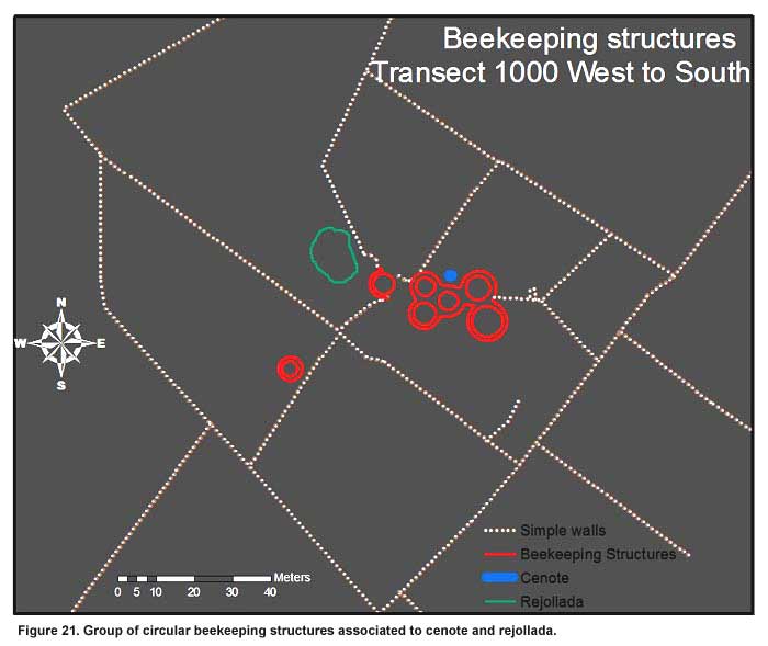
Figure 21. Group of circular beekeeping structures associated to cenote and rejollada.
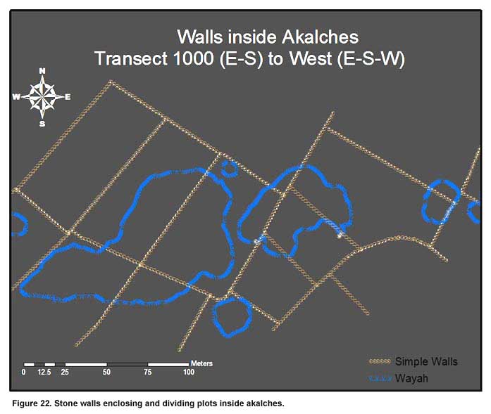
Figure 22. Stone walls enclosing and dividing plots inside akalches.
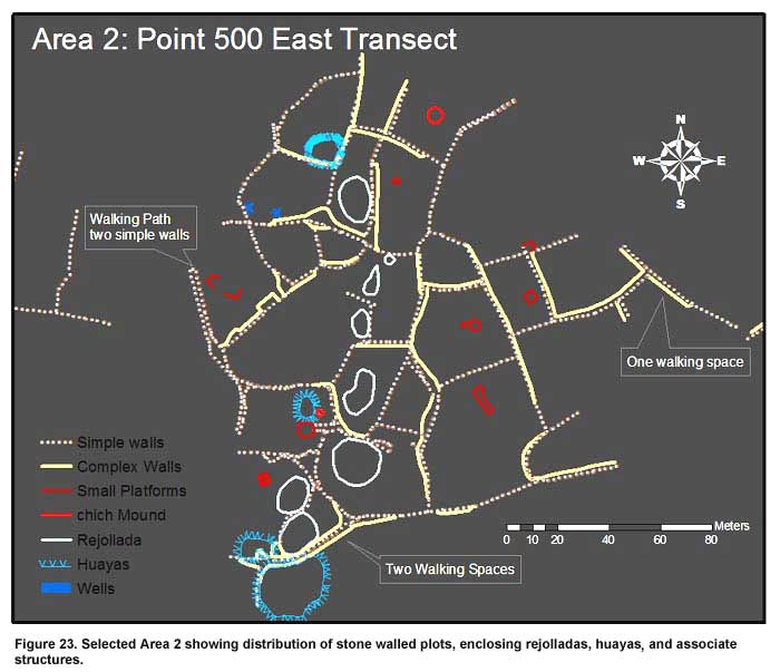
Figure 23. Selected Area 2 showing distribution of stone walled plots, enclosing rejolladas, huayas, and associate structures.
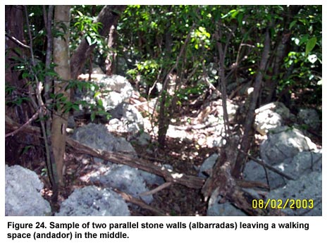
Figure 24. Sample of two parallel stone walls (albarradas) leaving a walking space (andador) in the middle.
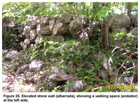
Figure 25. Elevated stone wall (albarrada), showing a walking space (andador) at the left side.
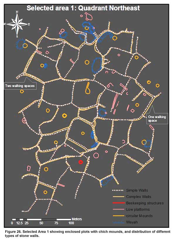
Figure 26. Selected Area 1 showing enclosed plots with chich mounds, and distribution of different types of stone walls.
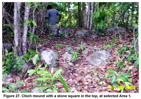
Figure 27. Chich mound with a stone square in the top, at selected Area 1.
Previous Page | Table of Contents | Next Page |