| FAMSI © 2005: David Wahl |
||
Environmental Change and Prehistoric Agriculture in the Mirador Basin
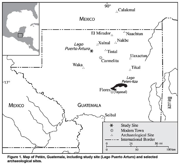
Background The Mirador Basin, located in the north central portion of the Petén, Guatemala and southern Campeche, México, is one of the more remote areas of the Maya Lowlands (Figure 1). The area today is comprised of extensive seasonal swamplands (bajos) interspersed with relatively well-drained ridges and slopes. Its intense dry season, lack of perennial water sources, and extensive swamps form a formidable barrier to settlement. Yet the area was densely populated in the Middle and Late Preclassic periods (1000 B.C.–A.D. 150) and modestly occupied during the Late Classic (A.D. 600-900). Archaeological and ecological investigations, primarily conducted by the Mirador Basin Project have revealed a long history of human settlement (Dahlin 1984; R.D. Hansen 1990, 1991, 1992, 1998; Howell and Copeland 1989; Matheny 1987). The earliest evidence of permanent structures dates to approximately 1000 B.C. By 400 B.C., there were nearly a dozen urban centers in the area, including the large centers of Nakbé and El Mirador. Evidence of such large populations has led researchers to examine the environmental setting during the rise of large centers as well as the possible role of environmental change in their demise, which occurred on at least two occasions (ca. A.D. 150 and A.D. 900). Previous paleoenvironmental work in the Mirador Basin has been limited by a lack of core material of sufficient age to allow a comparative analysis of the region before, during and after the periods of major Maya occupation. An initial pollen study on sediment from Aguada Zacatal, a Maya reservoir near Nakbé, established the existence of well-preserved microfossils (Weinstein 1993). In 1998, a series of sediment cores was raised from the aguada and a complete record was produced (Wahl 2000). The record, which covers the Late Classic to the present, shows two distinct zones; one of ecological disturbance and agriculture and one of forest regeneration and general stability. A dramatic shift in pollen and charcoal spectra between the zones marks the Classic period abandonment of the area (Wahl 2000). |
||
|
Text links to all pages at this site are available at the FAMSI INDEX |
||